- Introduction
- Tidal Energy
- Resource
- Constraints
- Phasing
- Economic Analysis
- Conclusions
- Downloads
Constraints
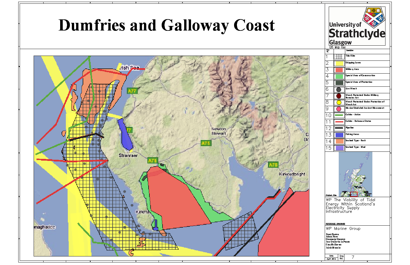
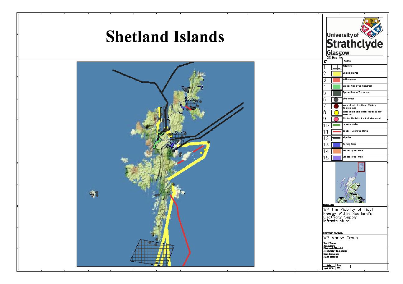
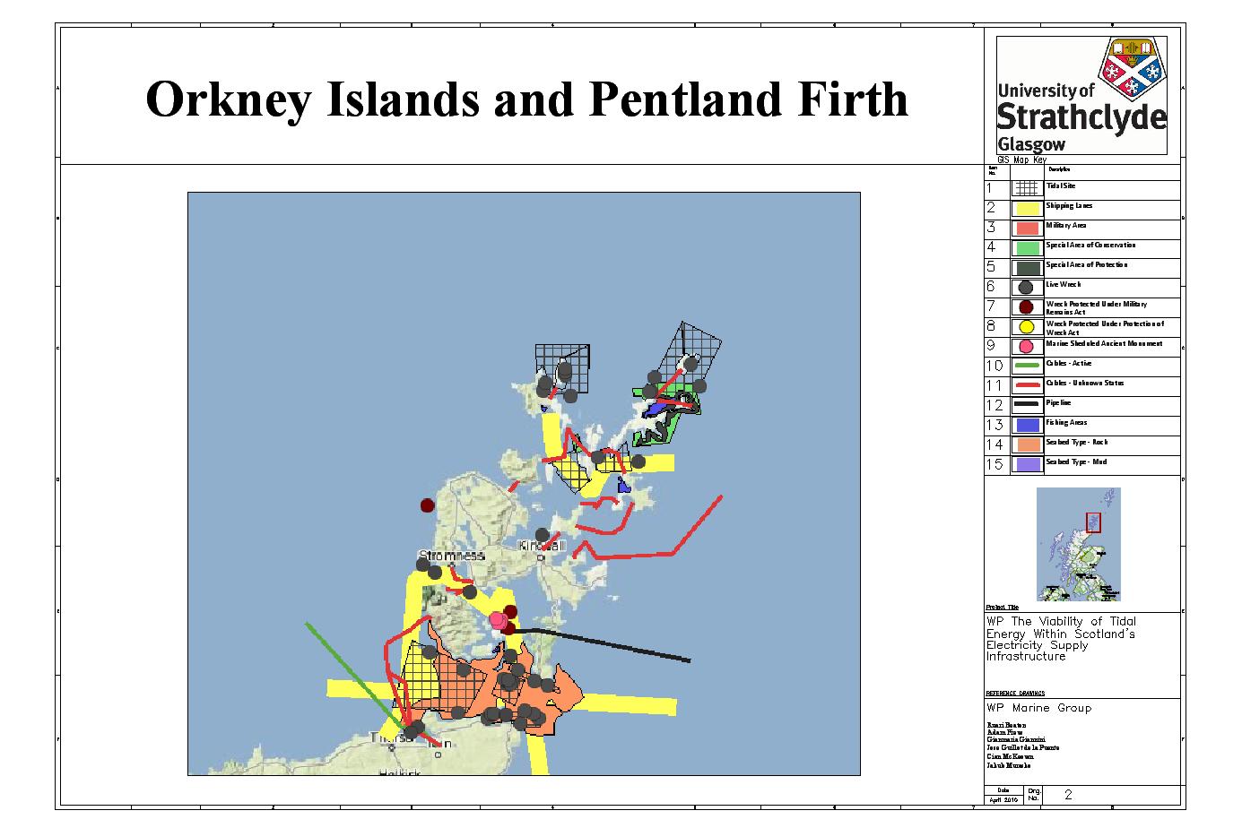
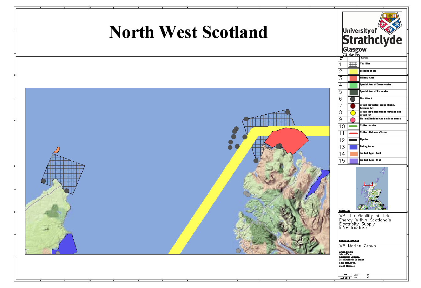
GIS Mapping Results
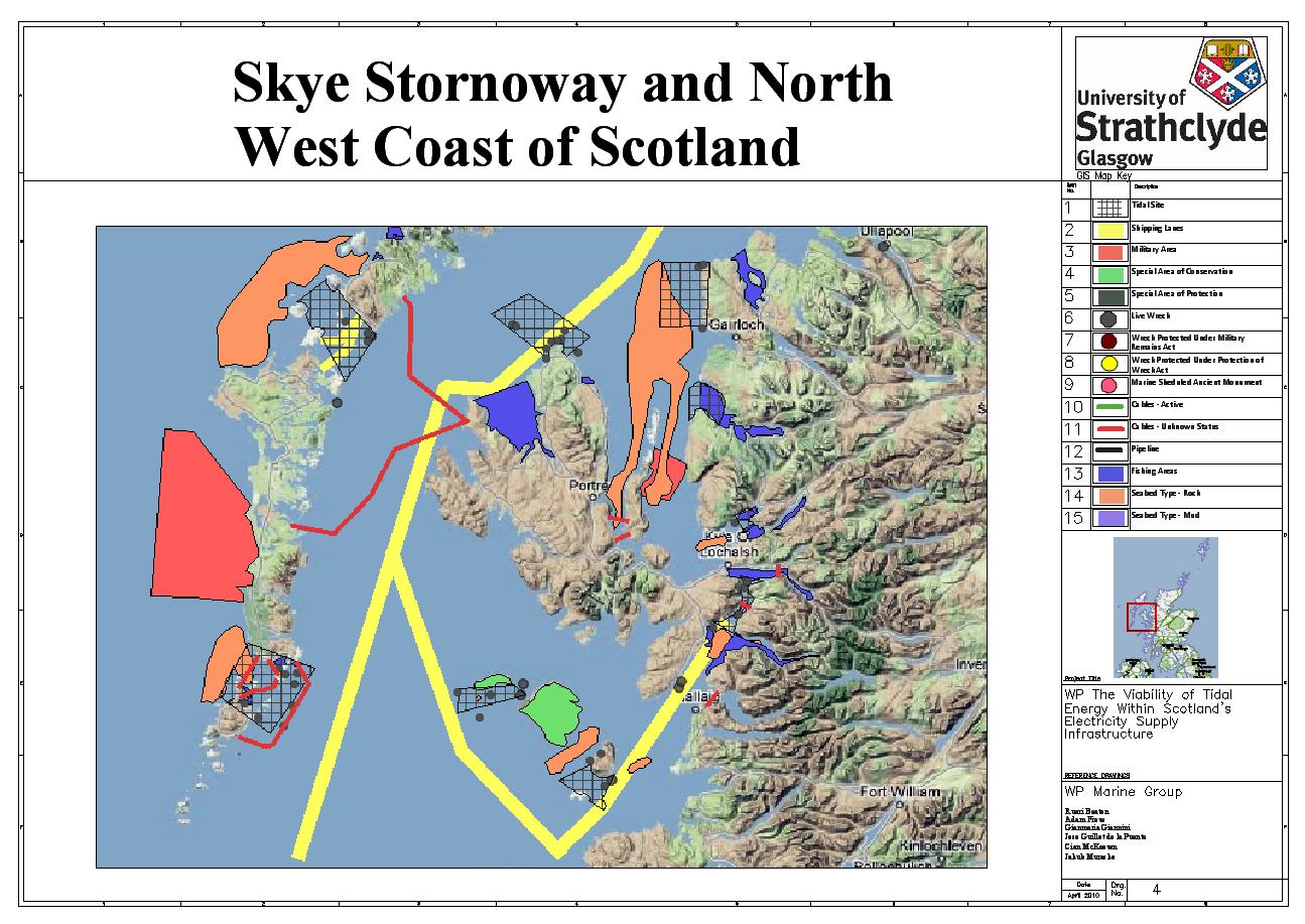
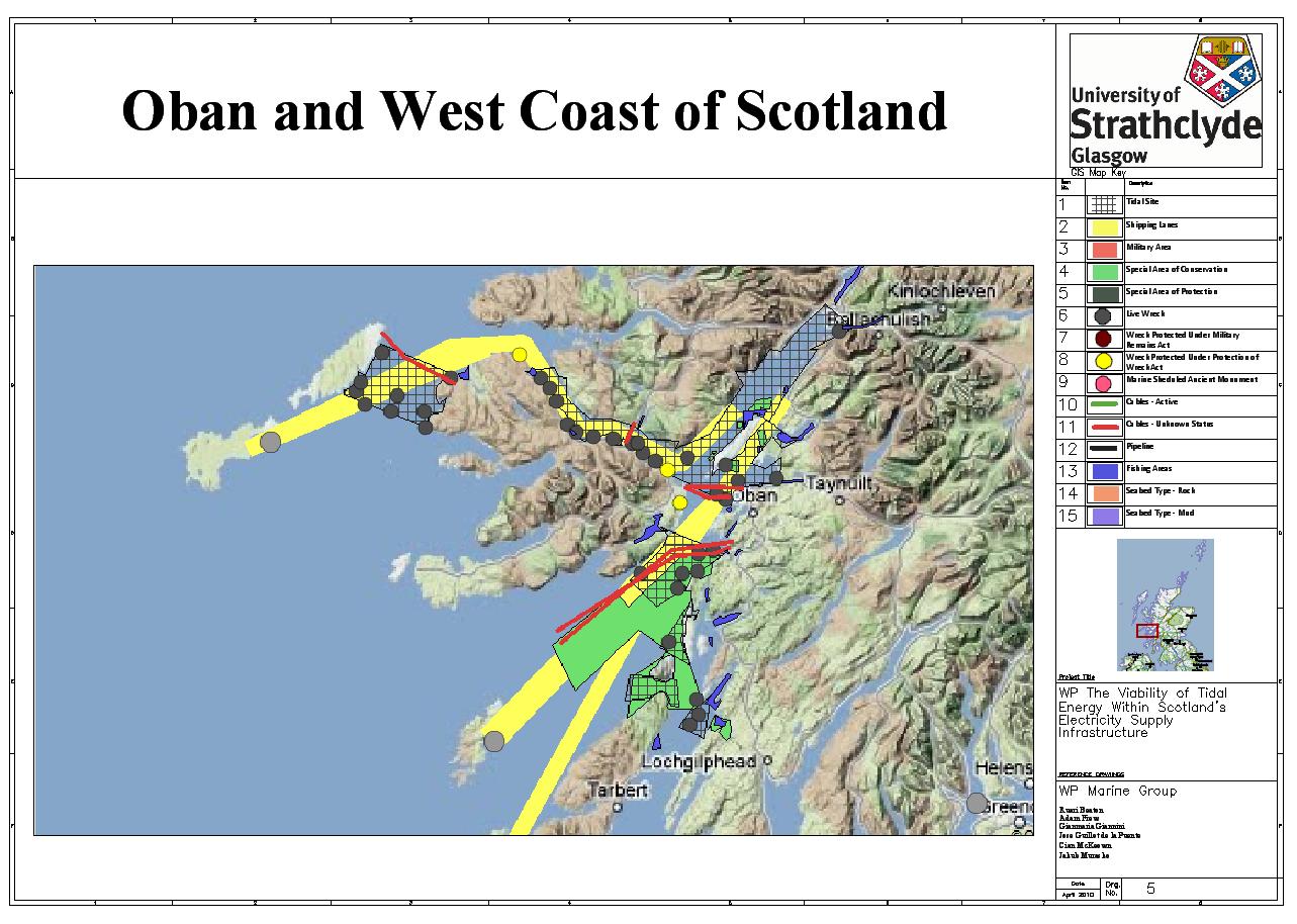
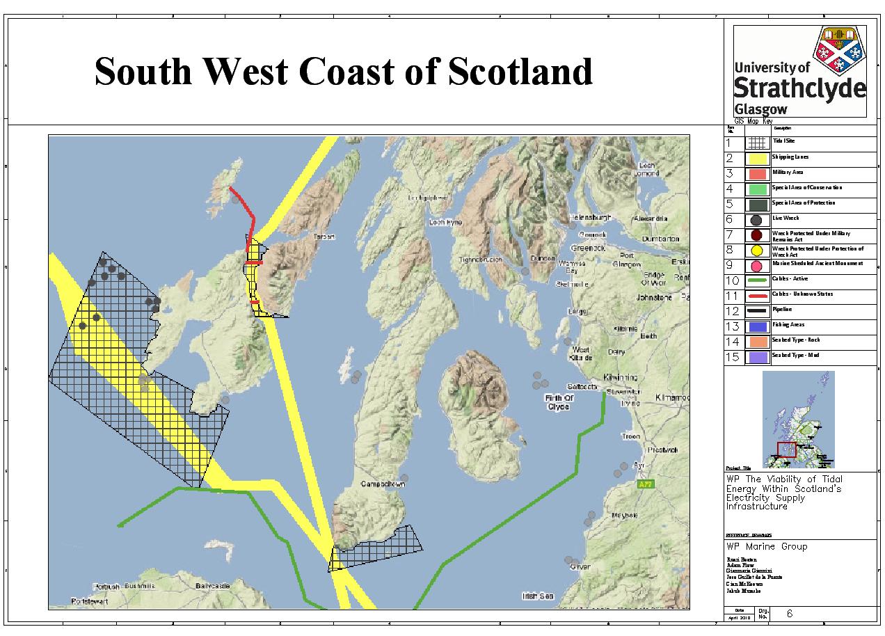
This page shows the GIS outputs for all the tidal areas that were analysed across Scotland. Each map has all constraints turned on to show the full impact of policy and technical constraints on Scotland's tidal resource. The regions were analysed separately so the user can see the exact technical or policy constraint that affects the resource in their region of study. The regions analysed in the study are shown in the table below.
Shetland Islands |
Orkney Islands and Pentland Firth |
North West Scotland |
Skye, Stornoway and North West Coast of Scotland |
Oban and West Coast of Scotland |
South West Coast of Scotland |
Dumfries and Galloway Coast |
Shetland Islands
Orkney Islands and Pentland Firth
North West Scotland
Skye, Stornoway and North West Coast of Scotland
Oban and West Coast of Scotland
South West Coast of Scotland
Dumfries and Galloway Coast