• Home
  • Project
  • Generation and Storage
    • Tidal Energy
    • Wave Energy
    • Storage Methods
  • Advisory Tool
    • Overview
    • Initial Assessment
    • Generation Matrices
    • Storage Matrices
    • Financial Analysis and Recommendation
  • Case Studies
    • Isle of Eigg
    • Isle of Islay
  • Results and Conclusions
  • Team
  • Downloads
  • Home
  • Project
  • Generation and Storage
    • Tidal Energy
    • Wave Energy
    • Storage Methods
  • Advisory Tool
    • Overview
    • Initial Assessment
    • Generation Matrices
    • Storage Matrices
    • Financial Analysis and Recommendation
  • Case Studies
    • Isle of Eigg
    • Isle of Islay
  • Results and Conclusions
  • Team
  • Downloads
  Coastal Renewable Energy
  • Home
  • Project
  • Generation and Storage
    • Tidal Energy
    • Wave Energy
    • Storage Methods
  • Advisory Tool
    • Overview
    • Initial Assessment
    • Generation Matrices
    • Storage Matrices
    • Financial Analysis and Recommendation
  • Case Studies
    • Isle of Eigg
    • Isle of Islay
  • Results and Conclusions
  • Team
  • Downloads

Case Study: Isle of Eigg

Picture

Background

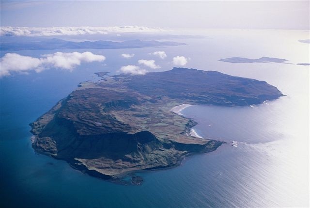
Eigg is a relatively sparsely populated island, with a permanent population of around 90 individuals.  It does however, present the ideal case study opportunity for the application of the advisory tool.  The Isle of Eigg Heritage Trust purchased the island in 1997 and installed the current community owned grid and renewable generation capacity, with the aid of substantial subsidies, over the course of the next two decades.
​
Possessing a well developed network, a community interested in the possibility of expansion, and having installed numerous onshore renewable generation devices, Eigg presents the opportunity to apply the tool to a real setting and investigate the incorporation or marine based renewables into an already established network.
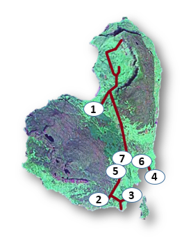
Picture

Location

Existing Grid and Renewable Capacity 

Eigg currently has an array of renewable generation devices installed, which operate in tandem with a lead acid battery storage system, and backup diesel generators, these energy sources are mainly concentrated in the southeast of the island although the grid covers all populated areas.
  1. Large Hydro - 10 kw
  2. Wind Turbines - 4 x 6 kW
  3. Small Hydro - 10 kW
  4. Small Hydro - 9 kW
  5. Diesel Generators - 70 kW
  6. Solar Array - 53.4 kW
  7. Lead Acid Battery Storage - 60 kW
Picture

Sites of Interest

Following the procedure laid out previously for the application of the advisory tool, the first stage is to identify potential locations of viable renewable resource and identify geographic areas which may allow for the installation of pumped hydro or compressed air storage.
Tidal Stream
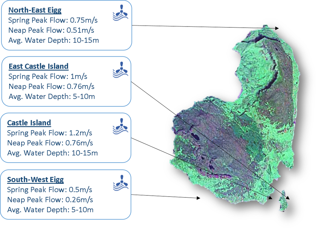
Several tidal stream areas were identified using the online UK Renewables Atlas, the relevant navigational charts for the area were also used to gauge the terrain and rule out areas with may not be suitable for deployment of tidal stream devices.  

Focus was on areas which may offer a viable connection to the existing grid while also meeting the technical requirements for tidal stream devices. Ultimately, four locations were chosen as the most likely to be viable and the details of these input to the decision matrix.
Picture
Tidal Range
Tidal range locations were identified in areas which offered a naturally restricted body of water with the requirement for the least additional construction, and significantly, suitable tidal range.   As a result of this, these locations are primarily in the Galmisdale Pier area of the island and make use of existing infrastructure.  The tidal data for these sites was obtained using UK Hydrographic Data for the tides in the Galmisdale Pier area.
​
The Bay of Laig, although being potentially too large for realsitic consideration, was chosen as an indicator of the maximum potential resource on the island and to demonstrate the input of community opinion on the final output of the advisory tool.
Picture
Wave
Wave resource was identified using the online UK Renewables Atlas with the greatest resource located in the south west of the Island.  This correlated with data gathered from the publication, Global Wave Statistics which stated the predominant wave direction to be from the south west.  Again, navigational charts were used to assess water depth and distance from shore.  This allowed for both near shore and offshore locations to be assessed using the location matrix. [1]
Picture
Picture
Pumped Hydro Storage
As pumped hydro storage was identified as the most effective solution, a topographical assessment of the island was required to identify areas of altitude which could accommodate such proposals.  Two areas were suggested, with Dunan Thalasgair being preferred due to desirable conditions atop the plateau which would, in reality, create a more suitable environment for construction.
Picture
Picture
Results
At this stage, in order to measure the competency of the tool in identifying the potential LCoE of recommended devices, a model of the existing system on Eigg was created using HOMER Pro software.  This process established a base LCoE of 0.21 £/kWh which roughly correlates to the current situation on the island.  The tables below show the final matrix selections, the decision tool cost analysis and simulation results.  A genuine correlation can be seen in the costs of energy predicted by both methods and the potential benefit seen in relation to the existing cost of energy on Eigg.

Full results can be seen in the Isle of Eigg case study, available on the Downloads page.
Picture
Picture
Picture
Picture

References

[1] G. F.(Collab.) Olliver Global Wave Statistics (1986)

Picture
Create a free web site with Weebly