 |
||||||||||||
ESRU |
||||||||||||
Site Choice and AnalysisIntoductionIn choosing a site for our channel model, the group looked at sites which had previously been identified as having significant potential for MCT deployment. However, our choice was limited very much by what data was readily available on tidal current velocities. Criterion for chosen site
At 2 separate ports located at either end of the channel
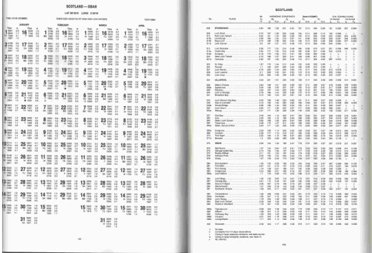
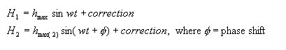
MethodologyThe values for HW and LW heights at both ports were used to derive a sinusoidal approximation of the variation in water height at those points, as follows: The Admiralty Tide Tables NP 201-04 Vol 1 (2004) was used to provide tide heights and times for the two ports identified on either side of the channel in question. A sample of those charts can be seen below
Fig 1: Primary Port (Oban) Fig 1: Secondary Ports (various)
For primary ports (i.e Oban) it was sufficient to simply read off the HW and LW heights and times for our purposes. However, for a secondary ports (such as Rona) a method of interpolation was required to calculate the HW/LW time and height as a deviation from its related primary port. This can be seen in Section x (include hyperlink here to scans of interpolation methods!!) From this data on HW height and times for our 2 ports, it was possible to approximate the variation in height via a sinusoidal approximation. This resulted in a function for height w.r.t time in the following form.
Therefore we have a function for height relative to time at 2 points either side of the channel. This then allowed the analysis of how the head difference would vary over time. The method for fluid flow due to a head difference was then employed to estimate the theoretical flow through the channel in question. (see full theory behind the method) This was then compared to the actual velocity data for the channel as given by the Admiralty Tidal Stream Atlas (see appendix).
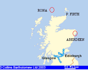
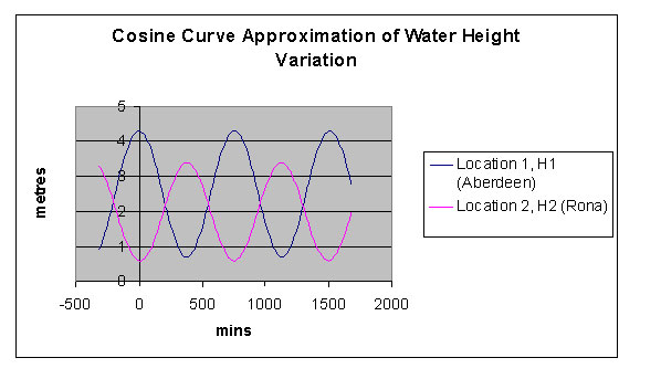
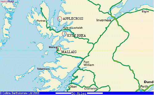
Chosen SitesThe 2 chosen channels for analysis were the Pentland Firth between the Northern Scottish mainland and Orkney, and Kyle Rhea on the West coast between Skye and the mainland. The decision to choose these sites was based on the fact that they have already been identified by third parties as having considerable potential for MCT deployment. But crucially there was also enough data on tidal stream velocity for both channels. These two points were major factors in opting for these two particular sites. Pentland FirthFor the two ports on either side of this channel to provide the water height and times, Aberdeen and Rona were chosen. The group felt that these two ports were of sufficient distance from the channel so as to represent the two wholly independent reservoirs of water.
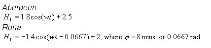
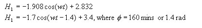
The cosine approximations for the two ports were defined as follows:
In this particular case the two waveforms were almost exactly ½ a wavelength out of phase. Hence the use of –ve cosine coefficient and only a small phase adjustment of 8 mins (0.0667 rad). When plotted on a graph with the same timescale, it is evident that our two ports have variation in water height which is out of phase with one another. This will lead to a resultant variation in head difference and can be interpreted in the channel model as the theoretical velocity through the channel.
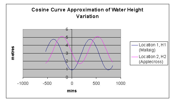
Kyle RheaFor the two ports on either side of this particular channel, in order to provide the water height and times, Malaig and Applecross were chosen
The cosine approximations for the two ports were defined as follows: Mallaig:
Again this modelled fairly well the variation in head difference and led to a respectable value for theoretical velocity in the channel (see channel model results).
|
||||||||||||