|
|
|
|
| Locating
A Site
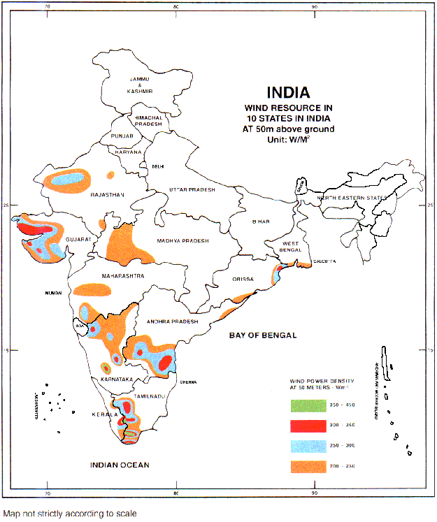
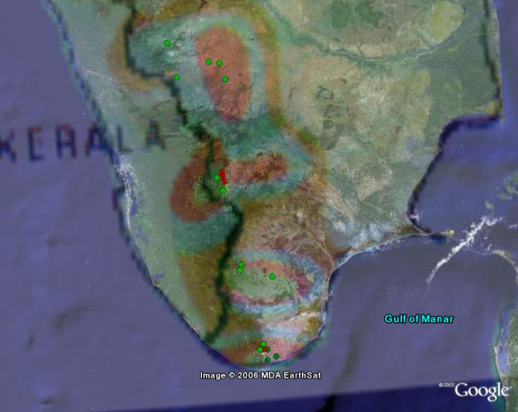
The objective of our project is to establish a methodology to be able to estimate the wind resource of any site in the world using data available in the public domain. It appears then logically that this methodology is particularly adapted to sites where the availability of traditional data sources are poor. At the suggestion of SgurrEnergy, who were interested in expanding into the area, we decided to study India, which is a good example of distant country (difficult to go and make some measurements and inspection of the sites) with some data which are of a poor quality in comparison with European countries. India seems then a good case study, but it is important to keep in mind that our methodology can be applied anywhere in the world. In order to locate good potential sites to situate a wind farm, WAsP could use the reanalysis and SRTM data at low resolution over the whole of India. It would then be possible to zoom in on areas that had the highest wind resource, for more detailed analysis. However due to limited computer processing power, an other solution was found. Google Earth is an useful tool in this part of the methodology. By pasting the wind resource map of India (available on internet) on Google Earth, we can zoom and investigate the zones with the highest wind potentials. We can then identify the presence of forests, mountains or other topographical characteristics.
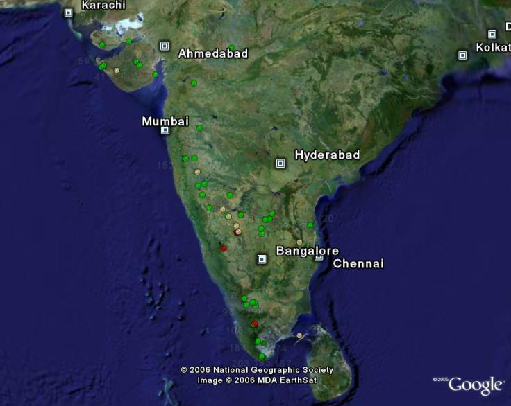
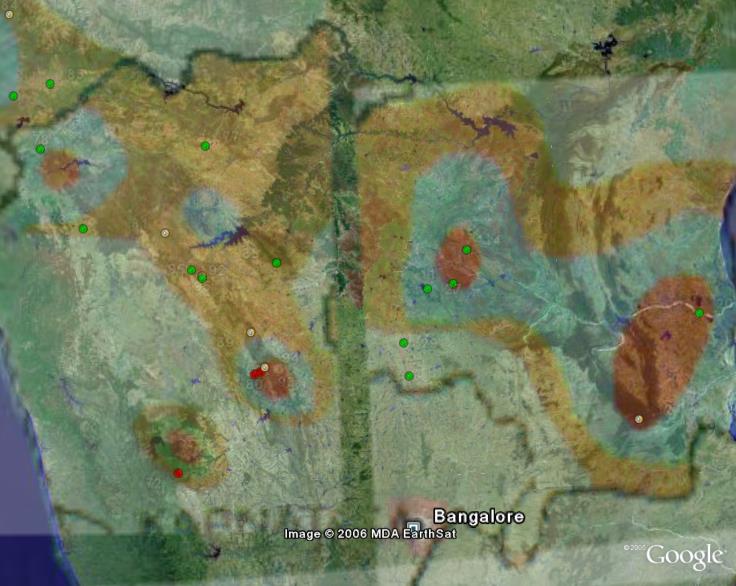
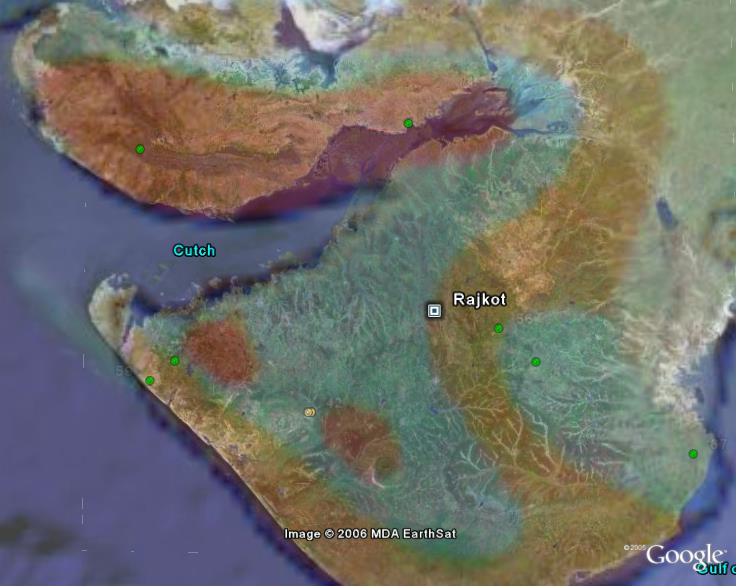
Once this combination of the Google Earth and wind maps, we used a list of more than 200 monitoring stations across India (also available on internet). We selected in this list the stations with the highest wind speeds registered (annual mean wind speed >22m/s), which we plotted on the Google Earth map by entering their coordinates. This allowed us to get a very good idea of the places with the highest wind resource. It was particularly interesting to observe that the sources of data (the wind resource map and the list of monitoring stations) correlates perfectly since we can observe that the red dots (highest speed: >25m/s) are always located in the green and red zones of the wind map (zones with the highest resource). The other dots also correlate well. This gives a good indication of the quality of the data since it is very important to always verify the data available (particularly for the data from internet) and to compare then with other data. A correlation between the different data indicates generally a good quality of data. We have then identified 4 very good sites in India with the highest wind potential (see table 2). These zones are located in the regions of Karnataka, Tamil-Nadu and Kerala. We have also chosen to study another zone (Gujarat) where the wind resource seems interesting but the data available seems poorer.
Now we have selected these zones, we can study their wind regime by getting the reanalysis data and topographical maps (SRTM) from these zones entering these data into WAsP. While doing that, we have to be careful and keep in mind that WAsP is not perfectly reliable in zones with very complex terrains. It is therefore important to look for places with smooth and simple terrains. Other factors that needed to be considered when locating good sites are;
Again, all this information was found by searching the internet. |