|
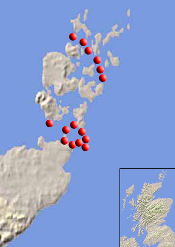
| Please select a site on the map to view the marine current
maximum speeds for that location. The table below displays the data captured
in the Resource Analysis stage. Using the Mean maximum values for Flood
and Ebb tide, the potential power can be calculated for each site. |
| Orkney, North Westray Firth |
| Latitude |
59¾13'7 N |
Longitude |
3¾03' W |
|
|
|
|
| Source |
Tidal Stream Table |
Chart 2249 |
Tidal Diamond B |
| |
|
|
|
|
|
|
|
|
|
| Tidal Flow |
Hours before/after HW |
Direction |
Spring Speed |
Neap Speed |
Mean Speed |
Time |
| Ebb/Flood |
Aberdeen |
¾ |
knots |
m/s |
knots |
m/s |
knots |
m/s |
GMT |
| Ebb |
-5 |
108 |
2.8 |
1.4 |
1.1 |
0.6 |
1.95 |
1.00 |
2/3/04 17:12 |
| Flood |
+1 |
290 |
2.9 |
1.5 |
1.1 |
0.6 |
2 |
1.03 |
27/2/04 17:12 |
| |
|
|
|
|
|
|
|
|
Back to top |
|
| Orkney, Central Westray Firth |
| Latitude |
59¾11'1N |
Longitude |
2¾52'1 W |
|
|
|
|
|
|
| Source |
Tidal Stream Table |
Chart 2249 |
Tidal Diamond E |
|
|
|
|
|
|
| |
| Tidal Flow |
Hours before/after HW |
Direction |
Spring Speed |
Neap Speed |
Mean Speed |
Time |
| Ebb/Flood |
Aberdeen |
¾ |
knots |
m/s |
knots |
m/s |
knots |
m/s |
GMT |
| Ebb |
-5 |
147 |
5 |
2.6 |
2 |
1.0 |
3.5 |
1.80 |
2/3/04 17:12 |
| Flood |
+1 |
324 |
5.1 |
2.6 |
2.1 |
1.1 |
3.6 |
1.85 |
27/2/04 17:12 |
| |
|
|
|
|
|
|
|
|
Back to top |
|
| Orkney, South Westray Firth |
| Latitude |
59¾08'1N |
Longitude |
2¾52'3 W |
|
|
|
|
|
|
| Source |
Tidal Stream Table |
Chart 2249 |
Tidal Diamond G |
|
|
|
|
|
|
| |
| Tidal Flow |
Hours before/after HW |
Direction |
Spring Speed |
Neap Speed |
Mean Speed |
Time |
| Ebb/Flood |
Aberdeen |
¾ |
knots |
m/s |
knots |
m/s |
knots |
m/s |
GMT |
| Flood |
-5 |
144 |
7.2 |
3.7 |
2.8 |
1.4 |
5 |
2.57 |
2/3/04 17:12 |
| Ebb |
+2 |
320 |
4.9 |
2.5 |
1.9 |
1.0 |
3.4 |
1.75 |
28/2/04 17:12 |
| |
|
|
|
|
|
|
|
|
Back to top |
|
| Orkney, Upper Stronsay Firth |
| Latitude |
59¾06'.1N |
Longitude |
2¾45'.0W |
|
|
|
|
|
|
| Source |
Tidal Stream Table |
Chart 2249 |
Tidal Diamond L |
|
|
|
|
|
|
| |
|
|
|
|
|
|
|
|
|
| Tidal Flow |
Hours before/after HW |
Direction |
Spring Speed |
Neap Speed |
Mean Speed |
Time |
| Ebb/Flood |
Aberdeen |
¾ |
knots |
m/s |
knots |
m/s |
knots |
m/s |
GMT |
| Flood |
-5 |
146 |
4.3 |
2.2 |
1.7 |
0.9 |
3 |
1.54 |
3/2/04 17:12 |
| Ebb |
1 |
328 |
3.4 |
1.7 |
1.4 |
0.7 |
2.4 |
1.23 |
2/27/04 17:12 |
| |
|
|
|
|
|
|
|
|
Back to top |
|
| Orkney, Central Stronsay Firth |
| Latitude |
59¾02'.2N |
Longitude |
2¾45'.0W |
|
|
|
|
|
|
| Source |
Tidal Stream Table |
Chart 2250-1992 |
Tidal Diamond G |
|
|
|
|
|
|
| |
| Tidal Flow |
Hours before/after HW |
Direction |
Spring Speed |
Neap Speed |
Mean Speed |
Time |
| Ebb/Flood |
Aberdeen |
¾ |
knots |
m/s |
knots |
m/s |
knots |
m/s |
GMT |
| Flood |
-5 |
191 |
2.2 |
1.1 |
0.9 |
0.5 |
1.55 |
0.80 |
2/3/04 17:12 |
| Ebb |
+2 |
346 |
2.1 |
1.1 |
0.8 |
0.4 |
1.45 |
0.75 |
28/2/04 17:12 |
| |
|
|
|
|
|
|
|
|
Back to top |
|
| Orkney, Lower Stronsay Firth |
| Latitude |
58¾59'.2N |
Longitude |
2¾41'.5W |
|
|
|
|
|
|
| Source |
Tidal Stream Table |
Chart 2250-1992 |
Tidal Diamond T |
|
|
|
|
|
|
| |
| Tidal Flow |
Hours before/after HW |
Direction |
Spring Speed |
Neap Speed |
Mean Speed |
Time |
| Ebb/Flood |
Aberdeen |
¾ |
knots |
m/s |
knots |
m/s |
knots |
m/s |
GMT |
| Flood |
-3 |
145 |
2.5 |
1.3 |
1.1 |
0.6 |
1.8 |
0.93 |
29/2/04 17:12 |
| Ebb |
+2 |
308 |
2.7 |
1.4 |
1.1 |
0.6 |
1.9 |
0.98 |
28/2/04 17:12 |
| |
|
|
|
|
|
|
|
|
Back to top |
|
| Pentland Firth, Duncansby Hd |
| Latitude |
58¾39'.0N |
Longitude |
3¾00'0 W |
|
|
|
|
|
|
| Source |
Tidal Stream Atlas |
NP209 |
|
|
|
|
|
|
|
| |
|
|
|
|
|
|
|
|
|
| Tidal Flow |
Hours before/after HW |
Direction |
Spring Speed |
Neap Speed |
Mean Speed |
Time |
| Ebb/Flood |
Dover |
¾ |
knots |
m/s |
knots |
m/s |
knots |
m/s |
GMT |
| Ebb |
-2 |
SW |
7 |
3.6 |
3 |
1.5 |
5 |
2.57 |
28/2/04 14:53 |
| Flood |
4 |
NW |
8 |
4.1 |
3.5 |
1.8 |
5.75 |
2.95 |
1/3/04 14:53 |
| |
|
|
|
|
|
|
|
|
Back to top |
|
| Pentland Firth, Between Duncansby Hd and Skerries |
| Latitude |
58¾39'.5N |
Longitude |
2¾58'0 W |
|
|
|
|
|
|
| Source |
Tidal Stream Atlas |
NP209 |
|
|
|
|
|
|
|
| |
|
|
|
|
|
|
|
|
|
| Tidal Flow |
Hours before/after HW |
Direction |
Spring Speed |
Neap Speed |
Mean Speed |
Time |
| Ebb/Flood |
Dover |
¾ |
knots |
m/s |
knots |
m/s |
knots |
m/s |
GMT |
| Flood |
-2 |
SW |
9 |
4.6 |
4 |
2.1 |
6.5 |
3.34 |
28/2/04 14:53 |
| Ebb |
4 |
NW |
8 |
4.1 |
3.5 |
1.8 |
5.75 |
2.95 |
1/3/04 14:53 |
| |
|
|
|
|
|
|
|
|
Back to top |
|
| Pentland Firth, South of Skerries |
| Latitude |
58¾40'.0N |
Longitude |
2¾55'0 W |
|
|
|
|
|
|
| Source |
Tidal Stream Atlas |
NP209 |
|
|
|
|
|
|
|
| |
|
|
|
|
|
|
|
|
|
| Tidal Flow |
Hours before/after HW |
Direction |
Spring Speed |
Neap Speed |
Mean Speed |
Time |
| Ebb/Flood |
Dover |
¾ |
knots |
m/s |
knots |
m/s |
knots |
m/s |
GMT |
| Flood |
-3 |
SW |
12 |
6.2 |
5 |
2.6 |
8.5 |
4.37 |
29/2/04 14:53 |
| Ebb |
4 |
NW |
8 |
4.1 |
3.5 |
1.8 |
5.75 |
2.95 |
1/3/04 14:53 |
| |
|
|
|
|
|
|
|
|
Back to top |
|
| Pentland Firth, North of Skerries |
| Latitude |
58¾40'.0N |
Longitude |
2¾55'0 W |
|
|
|
|
|
|
| Source |
Tidal Stream Atlas |
NP209 |
|
|
|
|
|
|
|
| |
|
|
|
|
|
|
|
|
|
| Tidal Flow |
Hours before/after HW |
Direction |
Spring Speed |
Neap Speed |
Mean Speed |
Time |
| Ebb/Flood |
Dover |
¾ |
knots |
m/s |
knots |
m/s |
knots |
m/s |
GMT |
| Flood |
-4 |
E |
8 |
4.1 |
3.5 |
1.8 |
5.75 |
2.95 |
1/3/04 14:53 |
| Ebb |
3 |
W |
5 |
2.6 |
2 |
1.0 |
3.5 |
1.80 |
29/2/04 14:53 |
| |
|
|
|
|
|
|
|
|
Back to top |
|
| Pentland Firth, South of South Ronaldsay |
|
|
|
|
|
|
|
|
|
| Latitude |
58¾42'.0N |
Longitude |
2¾55'5 W |
|
|
|
|
|
|
| Source |
Tidal Stream Atlas |
NP209 |
|
|
|
|
|
|
|
| |
|
|
|
|
|
|
|
|
|
| Tidal Flow |
Hours before/after HW |
Direction |
Spring Speed |
Neap Speed |
Mean Speed |
Time |
| Ebb/Flood |
Dover |
¾ |
knots |
m/s |
knots |
m/s |
knots |
m/s |
GMT |
| Flood |
-4 |
E |
8 |
4.1 |
3.5 |
1.8 |
5.75 |
2.95 |
1/3/04 14:53 |
| Ebb |
2 |
W |
6 |
3.1 |
2.5 |
1.3 |
4.25 |
2.18 |
28/2/04 14:53 |
| |
|
|
|
|
|
|
|
|
Back to top |
|
| Pentland Firth, Between Stroma and South Ronaldsay |
| Latitude |
58¾45'.0N |
Longitude |
3¾00'5 W |
|
|
|
|
|
|
| Source |
Tidal Stream Atlas |
NP209 |
|
|
|
|
|
|
|
| |
|
|
|
|
|
|
|
|
|
| Tidal Flow |
Hours before/after HW |
Direction |
Spring Speed |
Neap Speed |
Mean Speed |
Time |
| Ebb/Flood |
Dover |
¾ |
knots |
m/s |
knots |
m/s |
knots |
m/s |
GMT |
| Flood |
-2 |
S |
8 |
4.1 |
3.5 |
1.8 |
5.75 |
2.95 |
28/2/04 14:53 |
| Ebb |
4 |
NNE |
6 |
3.1 |
2.5 |
1.3 |
4.25 |
2.18 |
1/3/04 14:53 |
| |
|
|
|
|
|
|
|
|
Back to top |
|
| Pentland Firth, Outer Sound |
| Latitude |
58¾43'.0N |
Longitude |
3¾06'0 W |
|
|
|
|
|
|
| Source |
Tidal Stream Atlas |
NP209 |
|
|
|
|
|
|
|
| |
|
|
|
|
|
|
|
|
|
| Tidal Flow |
Hours before/after HW |
Direction |
Spring Speed |
Neap Speed |
Mean Speed |
Time |
| Ebb/Flood |
Dover |
¾ |
knots |
m/s |
knots |
m/s |
knots |
m/s |
GMT |
| Flood |
-2 |
E |
9 |
4.6 |
4 |
2.1 |
6.5 |
3.34 |
28/2/04 14:53 |
| Ebb |
4 |
W |
8 |
4.1 |
3.5 |
1.8 |
5.75 |
2.95 |
1/3/04 14:53 |
| |
|
|
|
|
|
|
|
|
Back to top |
|
| Pentland Firth, Inner Sound |
| Latitude |
58¾39'.5N |
Longitude |
3¾17'0 W |
|
|
|
|
|
|
| Source |
Tidal Stream Atlas |
NP209 |
|
|
|
|
|
|
|
| |
|
|
|
|
|
|
|
|
|
| Tidal Flow |
Hours before/after HW |
Direction |
Spring Speed |
Neap Speed |
Mean Speed |
Time |
| Ebb/Flood |
Dover |
¾ |
knots |
m/s |
knots |
m/s |
knots |
m/s |
GMT |
| Flood |
-3 |
E |
5 |
2.6 |
2 |
1.0 |
3.5 |
1.80 |
29/2/04 14:53 |
| Ebb |
+3 |
W |
5 |
2.6 |
2 |
1.0 |
3.5 |
1.80 |
29/2/04 14:53 |
| |
|
|
|
|
|
|
|
|
Back to top |
|
| Pentland Firth, South of Hoy |
| Latitude |
58¾46'.0N |
Longitude |
3¾07'5 W |
|
|
|
|
|
|
| Source |
Tidal Stream Atlas |
NP209 |
|
|
|
|
|
|
|
| |
|
|
|
|
|
|
|
|
|
| Tidal Flow |
Hours before/after HW |
Direction |
Spring Speed |
Neap Speed |
Mean Speed |
Time |
| Ebb/Flood |
Dover |
¾ |
knots |
m/s |
knots |
m/s |
knots |
m/s |
GMT |
| Ebb |
-3 |
E |
6 |
3.1 |
2.5 |
1.3 |
4.25 |
2.18 |
29/2/04 14:53 |
| Flood |
+3 |
W |
7 |
3.6 |
3 |
1.5 |
5 |
2.57 |
29/2/04 14:53 |
| |
|
|
|
|
|
|
|
|
Back to top |
|
| West Scotland, Northwest of Skye |
| Latitude |
57¾44'.2N |
Longitude |
6¾17'.7W |
|
|
|
|
|
|
| Source |
Tidal Stream Table |
Chart 1755-1991 |
Tidal Diamond C |
|
|
|
|
|
|
| |
| Tidal Flow |
Hours before/after HW |
Direction |
Spring Speed |
Neap Speed |
Mean Speed |
Time |
| Ebb/Flood |
Ullapool |
¾ |
knots |
m/s |
knots |
m/s |
knots |
m/s |
GMT |
| Flood |
-1 |
57 |
2.3 |
1.2 |
0.9 |
0.5 |
1.6 |
0.82 |
27/2/04 22:46 |
| Ebb |
5 |
241 |
2 |
1.0 |
0.8 |
0.4 |
1.4 |
0.72 |
2/3/04 22:46 |
| |
|
|
|
|
|
|
|
|
Back to top |
|
| West Scotland, Kyle of Rhea |
|
|
|
|
|
|
|
|
|
| Latitude |
57¾12'.0N |
Longitude |
5¾40'.0W |
|
|
|
|
|
|
| Source |
Tidal Stream Atlas |
NP218 |
|
|
|
|
|
|
|
| |
| Tidal Flow |
Hours before/after HW |
Direction |
Spring Speed |
Neap Speed |
Mean Speed |
Time |
| Ebb/Flood |
Dover |
¾ |
knots |
m/s |
knots |
m/s |
knots |
m/s |
GMT |
| Flood |
-1 |
S |
8 |
4.1 |
4.5 |
2.3 |
6.25 |
3.21 |
27/2/04 14:53 |
| Ebb |
5 |
N |
7.9 |
4.1 |
4.4 |
2.3 |
6.15 |
3.16 |
2/3/04 14:53 |
| |
|
|
|
|
|
|
|
|
Back to top |
|
| West Scotland, East of Eigg |
| Latitude |
56¾53'.5N |
Longitude |
6¾06'.0W |
|
|
|
|
|
|
| Source |
Tidal Stream Arrow |
Chart 2207-1993 |
|
|
|
|
|
|
|
| |
| Tidal Flow |
Hours before/after HW |
Direction |
Spring Speed |
Neap Speed |
Mean Speed |
Time |
| Ebb/Flood |
|
¾ |
knots |
m/s |
knots |
m/s |
knots |
m/s |
GMT |
| Flood |
-5 |
N |
4 |
2.1 |
3 |
1.5 |
3.5 |
1.80 |
11:15 |
| Ebb |
0 |
S |
4 |
2.1 |
3 |
1.5 |
3.5 |
1.80 |
11/2/04 11:15 |
| |
|
|
|
|
|
|
|
|
Back to top |
|
| West Scotland, Gulf of Corryvrecken |
| Latitude |
56¾09'.5N |
Longitude |
5¾43'.0W |
|
|
|
|
|
|
| Source |
Tidal Stream Arrow |
Chart 2326 |
|
|
|
|
|
|
|
| |
| Tidal Flow |
Hours before/after HW |
Direction |
Spring Speed |
Neap Speed |
Mean Speed |
Time |
| Ebb/Flood |
|
¾ |
knots |
m/s |
knots |
m/s |
knots |
m/s |
GMT |
| Flood |
-4 |
E |
8.5 |
4.4 |
6.5 |
3.3 |
7.5 |
3.9 |
11/2/04 10:07 |
| Ebb |
2 |
W |
8.5 |
4.4 |
6.5 |
3.3 |
7.5 |
3.9 |
11/2/04 16:07 |
| |
|
|
|
|
|
|
|
|
Back to top |
|
| West Scotland, Dorus Mor |
| Latitude |
56¾07'.5N |
Longitude |
5¾36'.5W |
|
|
|
|
|
|
| Source |
Tidal Stream Arrow |
Chart 2326 |
|
|
|
|
|
|
|
| |
| Tidal Flow |
Hours before/after HW |
Direction |
Spring Speed |
Neap Speed |
Mean Speed |
Time |
| Ebb/Flood |
|
¾ |
knots |
m/s |
knots |
m/s |
knots |
m/s |
GMT |
| Flood |
-3 |
W |
8 |
4.1 |
6 |
3.1 |
7 |
3.6 |
11/2/04 17:07 |
| Ebb |
+3 |
E |
6 |
3.1 |
4 |
2.1 |
5 |
2.6 |
11/2/04 11:07 |
| |
|
|
|
|
|
|
|
|
Back to top |
|
| West Scotland, Ruadh Sgeir Ledges |
| Latitude |
56¾11'.7N |
Longitude |
5¾39'.8W |
|
|
|
|
|
|
| Source |
Tidal Stream Arrow |
Chart 2326 |
|
|
|
|
|
|
|
| |
| Tidal Flow |
Hours before/after HW |
Direction |
Spring Speed |
Neap Speed |
Mean Speed |
Time |
| Ebb/Flood |
|
¾ |
knots |
m/s |
knots |
m/s |
knots |
m/s |
GMT |
| Flood |
-3 |
NE |
6 |
3.1 |
4 |
2.1 |
5 |
2.6 |
11/2/04 17:07 |
| Ebb |
+3 |
S |
4 |
2.1 |
2 |
1.0 |
3 |
1.5 |
11/2/04 11:07 |
| |
|
|
|
|
|
|
|
|
Back to top |
|
| West Scotland, Islay, Southwest of Orsay |
| Latitude |
55¾40'.0N |
Longitude |
6¾35'.0W |
|
|
|
|
|
|
| Source |
Tidal Stream Arrow |
Chart 1770 |
|
|
|
|
|
|
|
| |
| Tidal Flow |
Hours before/after HW |
Direction |
Spring Speed |
Neap Speed |
Mean Speed |
Time |
| Ebb/Flood |
|
¾ |
knots |
m/s |
knots |
m/s |
knots |
m/s |
GMT |
| Flood |
0 |
N |
8.00 |
4.1 |
6.00 |
3.1 |
7.00 |
3.6 |
|
| Ebb |
+6 |
S |
8.00 |
4.1 |
6.00 |
3.1 |
7.00 |
3.6 |
|
| |
|
|
|
|
|
|
|
|
Back to top |
|
| Kintyre, South of Mull |
| Latitude |
55¾18'.0N |
Longitude |
5¾48'.0W |
|
|
|
|
|
|
| Source |
Tidal Stream Arrow |
Chart 2199 |
|
|
|
|
|
|
|
| |
| Tidal Flow |
Hours Hours before/after HW |
Direction |
Spring Speed |
Neap Speed |
Mean Speed |
Time |
| |
Dover |
¾ |
knots |
m/s |
knots |
m/s |
knots |
m/s |
GMT |
| Flood |
0 |
N |
6.00 |
3.1 |
3.50 |
1.8 |
4.75 |
2.4 |
26/2/04 23:58 |
| Ebb |
+6 |
S |
6.00 |
3.1 |
3.50 |
1.8 |
4.75 |
2.4 |
3/3/04 23:58 |
| |
|
|
|
|
|
|
|
|
Back to top |
|
| Kintyre, Southwest of Sanda |
| Latitude |
44¾12'1 N |
Longitude |
5¾37'2 W |
|
|
|
|
|
|
| Source |
Tidal Stream Table |
Chart 2199 |
Tidal Diamond B |
|
|
|
|
|
|
| |
| Tidal Flow |
Hours Hours before/after HW |
Direction |
Spring Speed |
Neap Speed |
Mean Speed |
Time |
| Ebb/Flood |
Londonderry |
¾ |
knots |
m/s |
knots |
m/s |
knots |
m/s |
GMT |
| Flood |
0 |
91 |
3.4 |
1.7 |
2.1 |
1.1 |
2.75 |
1.41 |
26/2/04 23:58 |
| Ebb |
+6 |
272 |
3.3 |
1.7 |
2 |
1.0 |
2.65 |
1.36 |
3/3/04 23:58 |
| |
|
|
|
|
|
|
|
|
Back to top |
|
| Kintyre, Sanda Sound |
| Latitude |
55¾17'.0N |
Longitude |
5¾36'.0W |
|
|
|
|
|
|
| Source |
Tidal Stream Arrow |
Chart 2126-1992 |
|
|
|
|
|
|
|
| |
| Tidal Flow |
Hours Hours before/after HW |
Direction |
Spring Speed |
Neap Speed |
Mean Speed |
Time |
| Ebb/Flood |
|
¾ |
knots |
m/s |
knots |
m/s |
knots |
m/s |
GMT |
| Flood |
-3 |
NE |
5 |
2.6 |
4 |
2.1 |
4.5 |
2.31 |
14/2/04 11:15 |
| Ebb |
+3 |
SE |
5 |
2.6 |
4 |
2.1 |
4.5 |
2.31 |
14/2/04 11:15 |
| |
|
|
|
|
|
|
|
|
Back to top |
|
| Galloway, South of Mull |
| Latitude |
54¾35'.5N |
Longitude |
4¾50'.1W |
|
|
|
|
|
|
| Source |
Tidal Stream Table |
Chart 1411-1979 |
Tidal Diamond E |
|
|
|
|
|
|
| |
| Tidal Flow |
Hours before/after HW |
Direction |
Spring Speed |
Neap Speed |
Mean Speed |
Time |
| Ebb/Flood |
Liverpool (Alfred Dock) |
¾ |
knots |
m/s |
knots |
m/s |
knots |
m/s |
GMT |
| Flood |
-3 |
85 |
4.5 |
2.3 |
2.5 |
1.3 |
3.5 |
1.80 |
29/2/04 15:01 |
| Ebb |
+3 |
247 |
3.7 |
1.9 |
2.1 |
1.1 |
2.9 |
1.49 |
29/2/04 15:01 |
| |
|
|
|
|
|
|
|
|
Back to top |
|
| Galloway, Burrow Head |
| Latitude |
54¾35'.5N |
Longitude |
4¾50'.1W |
|
|
|
|
|
|
| Source |
Tidal Stream Table |
Chart 1411-1979 |
Tidal Diamond E |
|
|
|
|
|
|
| |
| Tidal Flow |
Hours before/after HW |
Direction |
Spring Speed |
Neap Speed |
Mean Speed |
Time |
| Ebb/Flood |
Liverpool (Alfred Dock) |
¾ |
knots |
m/s |
knots |
m/s |
knots |
m/s |
GMT |
| Flood |
-3 |
76 |
2.7 |
1.4 |
1.7 |
0.9 |
2.2 |
1.13 |
29/2/04 15:01 |
| Ebb |
+3 |
254 |
2.3 |
1.2 |
1.4 |
0.7 |
1.85 |
0.95 |
29/2/04 15:01 |
|